
MAPPING AND GRAPHICS
Our geospatial professionals work with:
– Geographic Information Systems (GIS)
– Computer Aided Drafting (CAD) drawings
– Geospatial database management
– Global Positioning System (GPS), Total Station, Photogrammetric and Drone mapping
– Heads-up digitizing (on-screen)
– Photo, map, and graphic production
– Geophysical investigations
–– Ground Penetrating Radar (GPR)
–– Magnetic gradiometry
–– Electrical resistivity
–– Thermal imaging
GIS ANALYSIS
Our specialists produce:
– Geostatistical, viewshed, and image analyses
– Visual simulations
– Predictive models
– 3-D analysis/visualizations for architecture and landscapes
SPATIAL DATA MANAGEMENT AND SOFTWARE
– Geodatabases/shapefiles in ArcGIS
– Global Mapper, Pathfinder, TDS Survey Works, DNR Garmin
– DEMs, DOQQs, LiDAR, MrSID, ASCII, GeoTIFF, Esri Grid, DLG, CAD and KML formats
– Mobile-based geospatial applications (Gaia, TerraFlex, Collector for ArcGIS, MobileMapper)
– Focus on interoperability for clients
SPECIALIZED EQUIPMENT
We have the following equipment in-house:
– Total Station and Recon data collector
– Survey grade Trimble GPS units
– Garmin units
– DJI Phantom Drone
– DSLR cameras
– Geophysical equipment, close-range laser scanner, RTK GPS units
Geospatial/GIS Project Portfolio
Browse three examples of recent successfully completed geospatial/GIS projects.
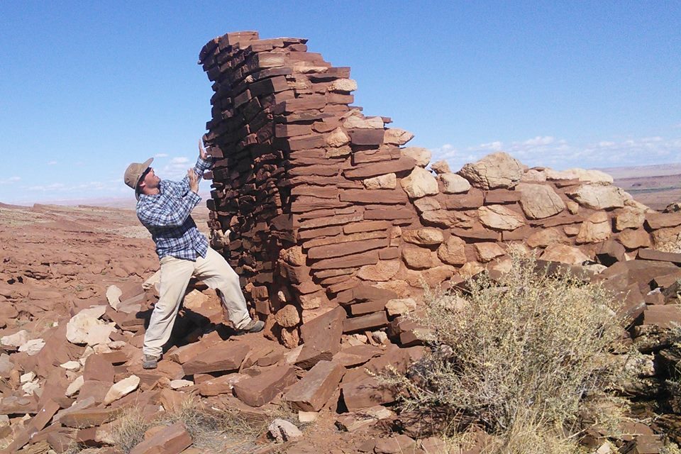
Photogrammetric Mapping at Three Sites in Wupatki National Monument
EnviroSystems conducted architectural mapping and drone aerial imaging of three sites at Wupatki National Monument, Arizona. The Monument required scaled planimetric drawings and cross-sections of standing architecture at WS323/Small Tower, WS1027/Cloud House, and WS1762/Coyote Water.
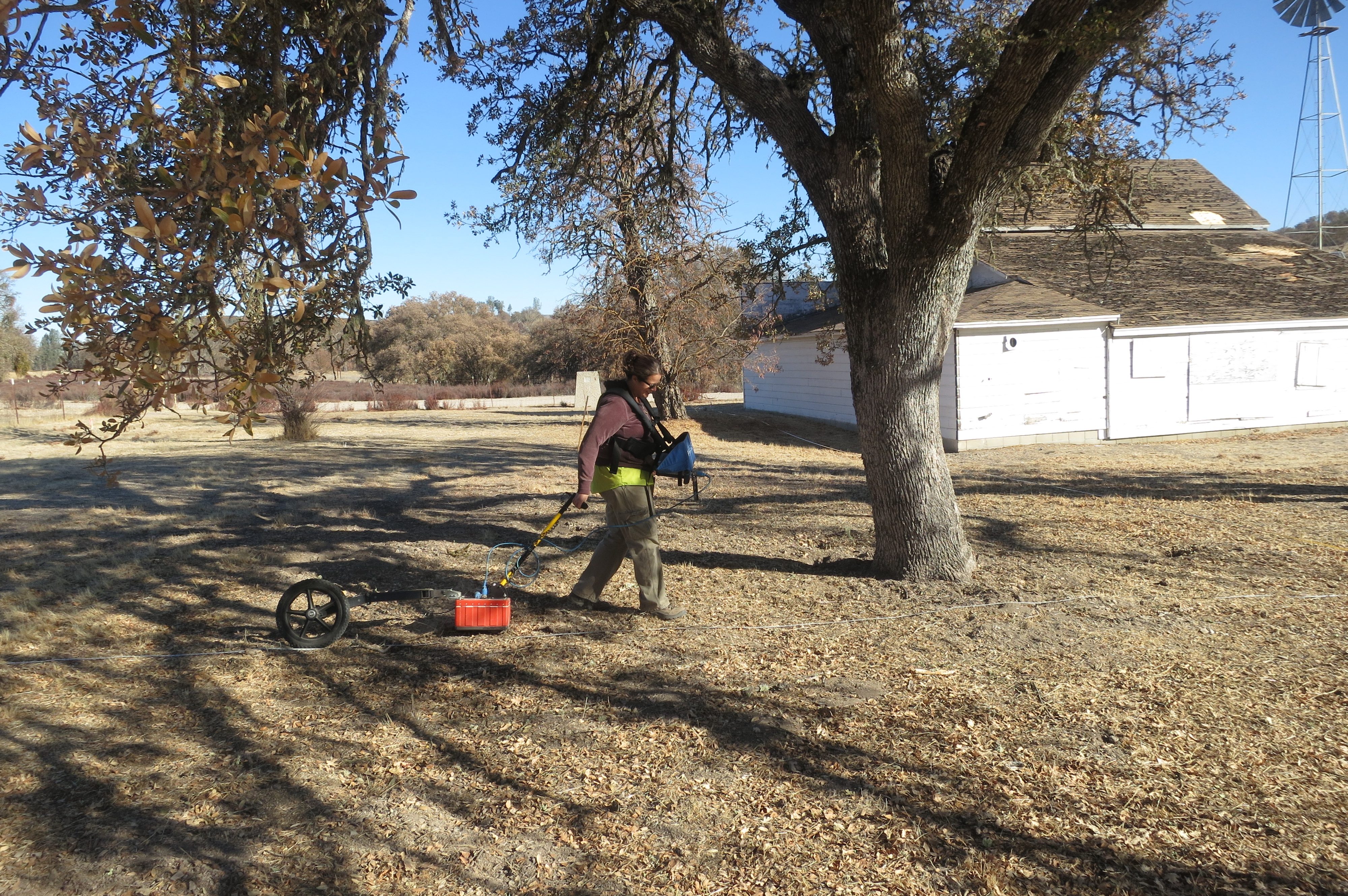
Archaeological Geophysical Survey of the Tidball Property, Fort Hunter Liggett
EnviroSystems and Gulf South Research Corporation (GSRC) conducted a geophysical survey of the property surrounding the Tidball Store Site, CA-MNT-794H, at Fort Hunter Liggett, California. The investigation used Ground Penetrating Radar (GPR) in an effort to better identify and interpret several anomalies that may represent historic features.
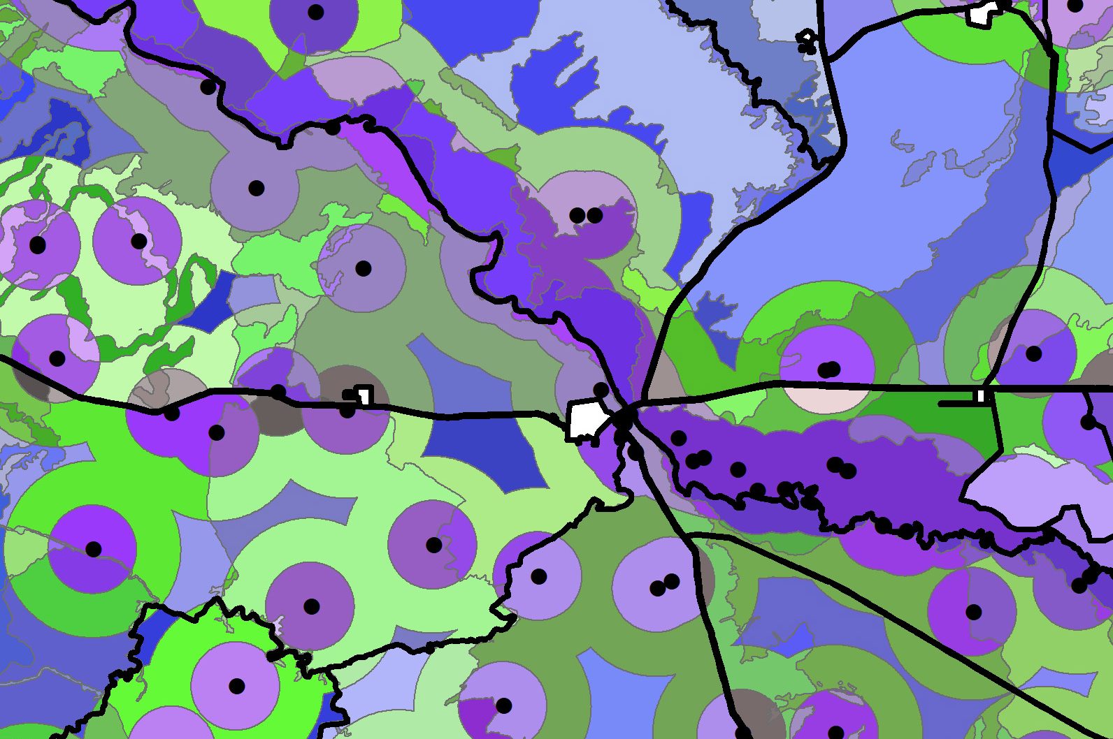
Vegetation Inventory Study for Land Management District 5, Navajo Nation, Arizona
EnviroSystems conducted a 690-transect vegetation inventory on the Navajo Nation. Through geoprocessing, we combined soils types, slopes, and buffer distances to determined the appropriate useable potential livestock and wildlife forage in relation to available water in an arid environment.