Environmental Regulatory Compliance Projects
Browse examples of recent successfully completed regulatory compliance projects.

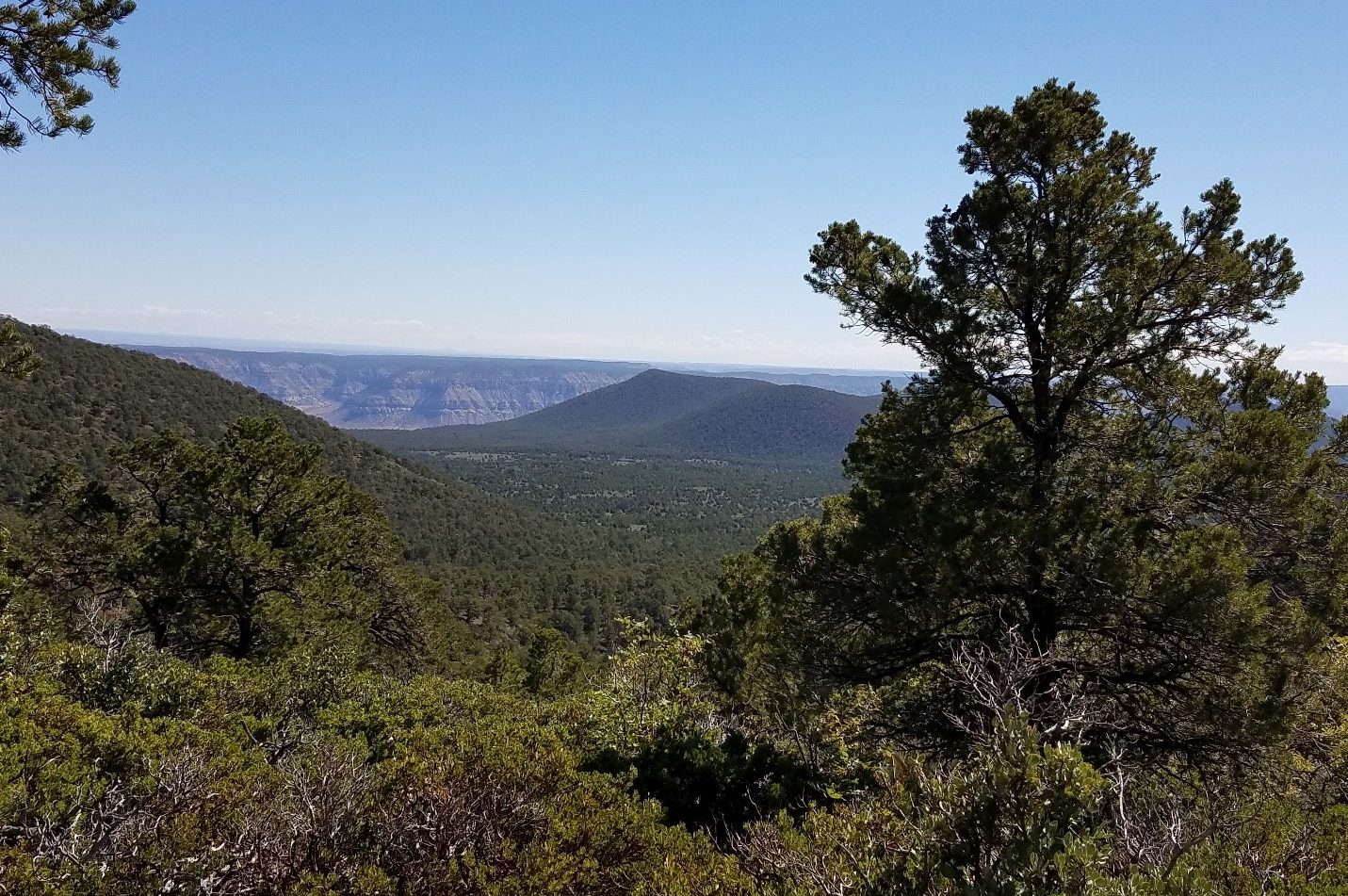
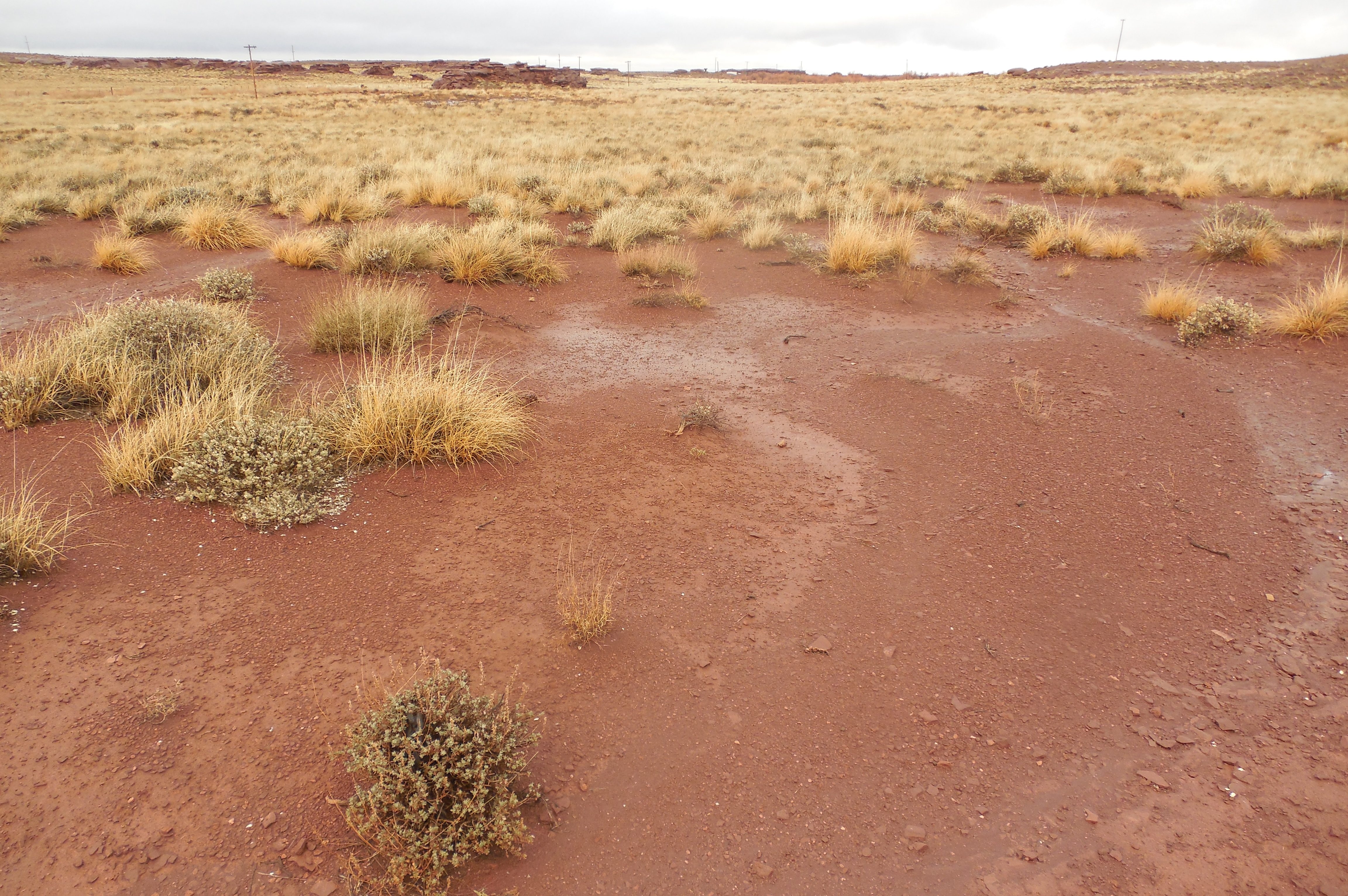
Show Low South Land Exchange Multi-Forest Environmental Impact Statement, Central Arizona
Show More
EnviroSystems prepared the Environmental Impact Statement and Record of Decision (finalized in 2013) in compliance with NEPA for the proposed Show Low South Land Exchange involving 12 parcels on the Apache-Sitgreaves, Coconino, and Prescott national forest and private lands located throughout northern Arizona. Biological surveys, cultural resource surveys, Phase I ESAs, and Mexican spotted owl and northern goshawk surveys were completed for some or all of the parcels involved in the exchange.

BLM Utah Skutumpah Terrace and Paria Watershed Habitat Restoration Environmental Assessments
Show More
EnviroSystems was contracted by the State of Utah to complete two EAs for habitat restoration for the BLM Kanab Field Office and Grand Staircase Escalante National Monument. Based on watershed boundaries, the BLM determined the purpose and need for habitat restoration to improve watershed conditions including water availability, soil stability, vegetation cover, etc. EnviroSystems is assisting the BLM in all phases of the EA process and impact topics to be analyzed include air quality, recreation, visual resources, sensitive species, wildlife, vegetation, geology and soils, cultural resources, and socioeconomics. EnviroSystems is also assisting the BLM with preparation of mitigation measures designed to reduce the impact of this project on the natural resources/cultural values. The EAs are being prepared per the most recent BLM NEPA guidance released in 2015.

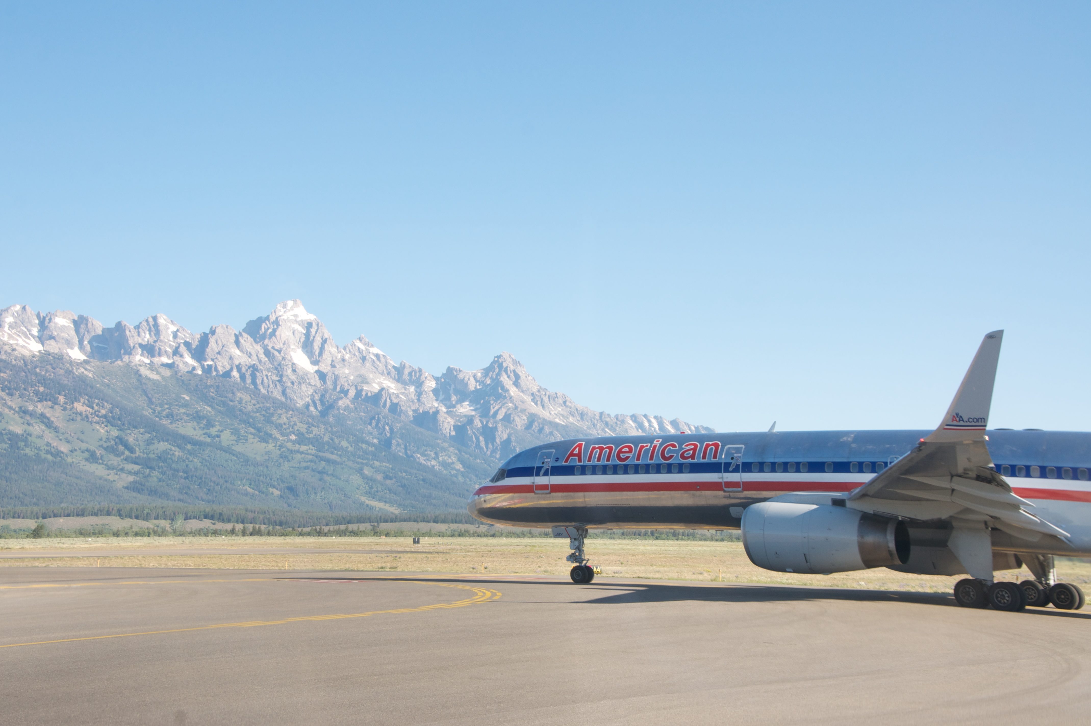
Jackson Hole Airport Sage-Grouse Habitat Restoration Plan Environmental Assessment, Grand Teton National Park, Jackson, Wyoming
Show More
EnviroSystems was contracted to complete an Environmental Assessment and associated Biological Assessment (BA) to analyze alternatives for a sage-grouse management plan presented in the 2014 Wildlife Hazard Mitigation Plan (WHMP) for Jackson Hole Airport. Based on the WHMP, the Environmental Assessment focuses on a number of actions to be taken by the National Park Service on park lands near the airport and on lands within the boundary including creating new habitat and managing current sage-grouse habitat and populations.

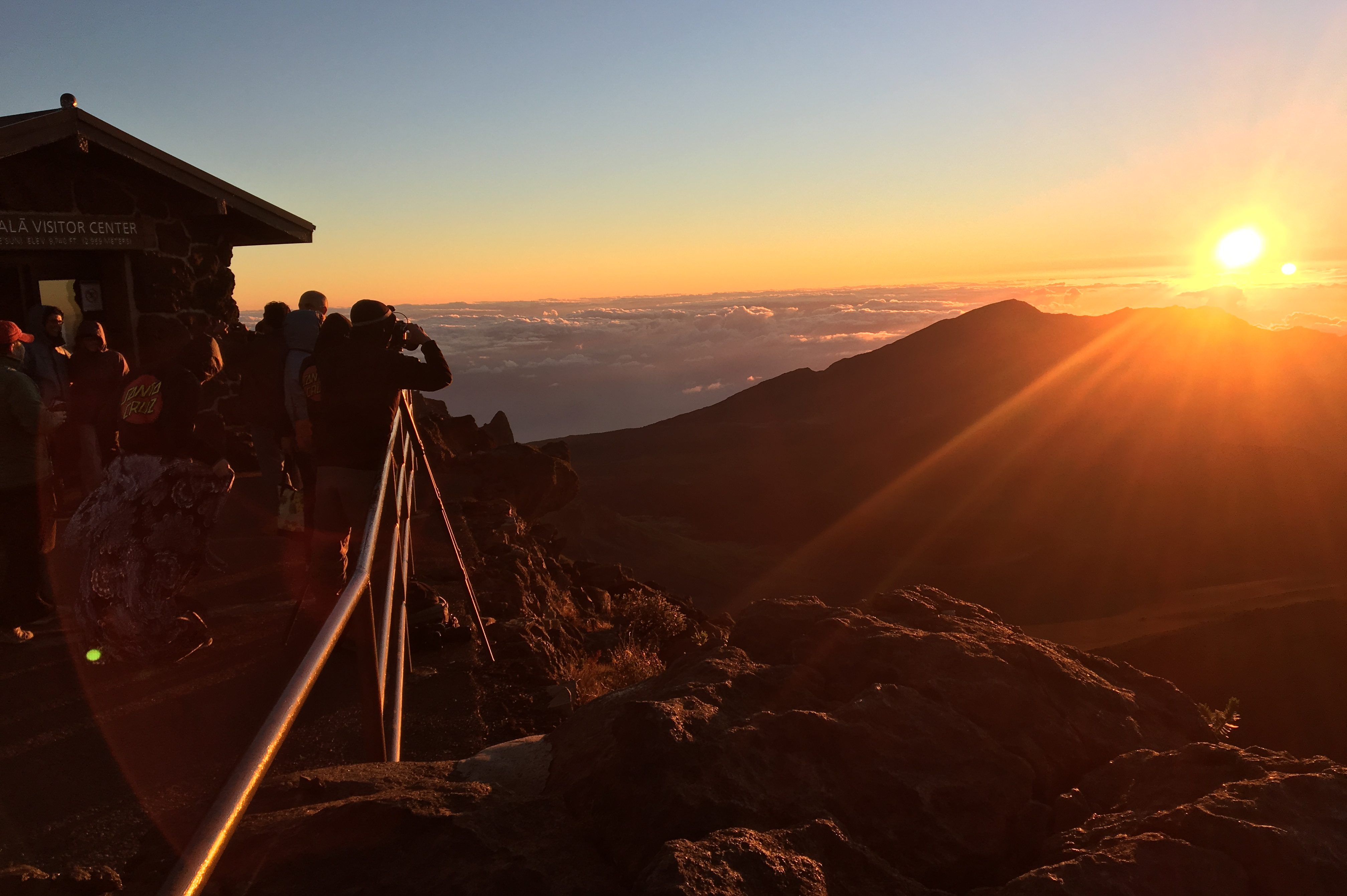
Haleakalā National Park Sunrise Visitation Environmental Assessment, Haleakalā National Park, Maui, Hawaii
Show More
EnviroSystems was contracted to complete an Environmental Assessment for Haleakalā National Park to analyze the effects of possible solutions to the problems of overcrowding at the Haleakalā summit during sunrise hours. Sunrise viewing at the summit of Haleakalā is a top visitor attraction on Maui. Pre-dawn through sunrise is the busiest time of day and there has been an ongoing, steady, and significant increase in sunrise visitation. The steady increase in sunrise summit visitation has raised concerns about safety of employees and visitors, as well as impacts to natural and cultural resources, and it was determined that a plan was needed to manage sunrise summit visitation in the park.

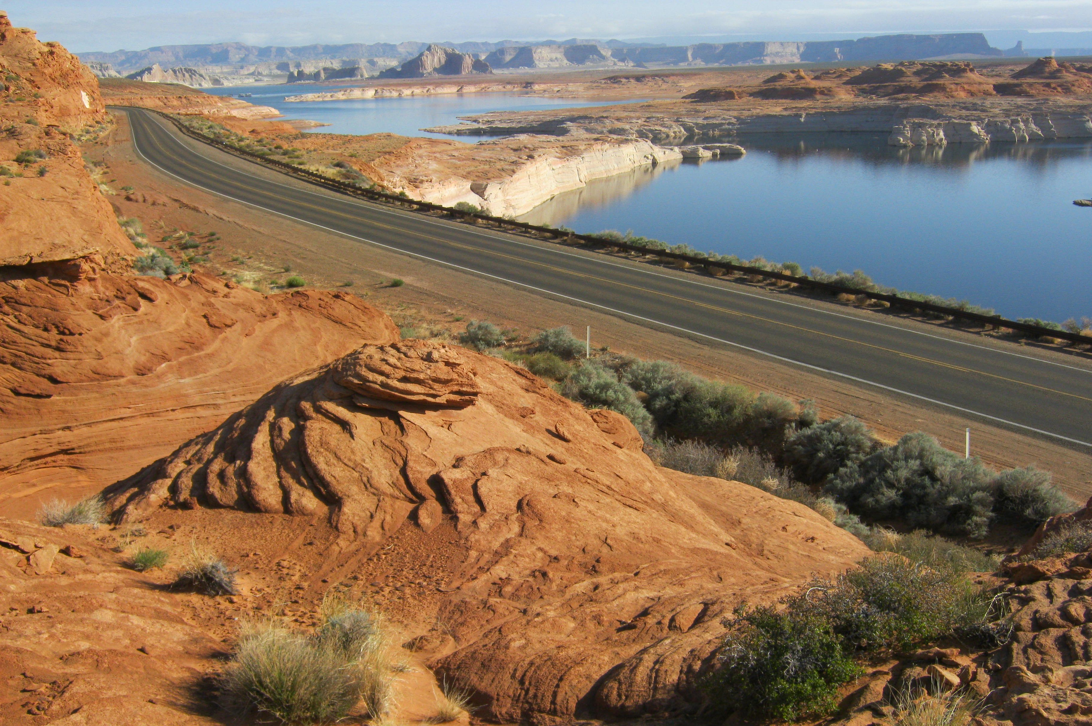
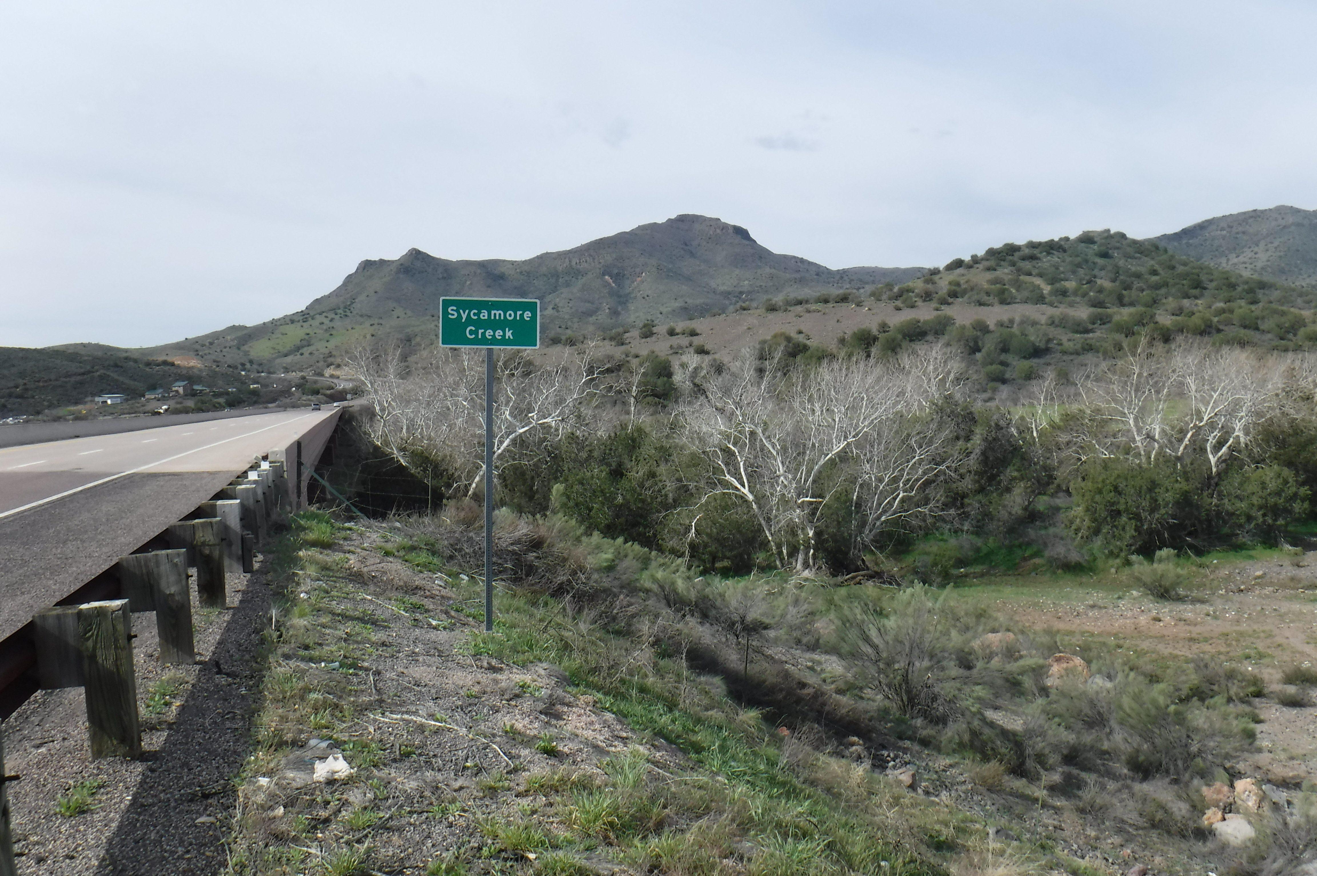
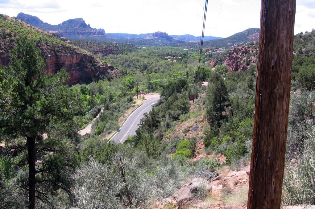
Lakeshore Drive/Wahweap Boulevard Road Rehabilitation Environmental Assessment, Page, Arizona
Show More
EnviroSystems prepared an Environmental Assessment to disclose and analyze the environmental consequences of rehabilitating, restoring, and resurfacing of approximately 8.56 miles of roads within the Glen Canyon National Recreation Area. It is a site-specific analysis of potential impacts that could result from the implementation of the preferred alternative and the no-action alternative.

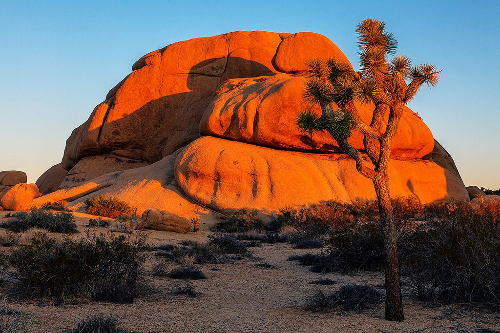
Invasive Plant Management Plan & Programmatic Environmental Assessment for Joshua Tree National Park, Twenty Nine Palms, California
Show More
EnviroSystems held a contract with the Joshua Tree National Park to develop an Invasive Plant Management Plan and complete a programmatic Environmental Assessment analyzing the potential impacts of the implementation of the plan. Joshua Tree National Park covers nearly 800,000 acres and spans the Colorado Desert and Mojave Desert ecosystems. With more than 2 million visitors each year, the park faces significant threats from the introduction of exotic/invasive species. Proposed treatment methodologies include manual, mechanical, chemical, cultural, and biological, based in an adaptive management framework.

Show Low to Payson Fiber Optic Cable Line Environmental and Cultural Clearance, Tonto and Apache-Sitgreaves National Forests
Show More
EnviroSystems prepared NEPA documents and supporting cultural/biological survey sand documents for the Apache-Sitgreaves and Tonto National Forests to issue Cable One a permit to install a fiber optic cable in existing Arizona Department of Transportation, Arizona Public Service, and Navopache Electric Cooperative rights-of-way or easements. The proposed project consists of installation of a 79.3-mile-long Cable One fiber optic cable from Payson to Show Low in Gila, Coconino, and Navajo Counties, Arizona.

Payson to Phoenix Fiber Optic Cable Line Environmental and Cultural Clearance, Tonto National Forest
Show More
EnviroSystems is in the process of preparing NEPA documents and supporting cultural/biological surveys/documents for the Tonto National Forest to issue Cable One a permit to install a fiber optic cable in existing Arizona Department of Transportation, municipal, and Arizona Public Service rights-of-way or easements. The proposed project consists of installation of a Cable One fiber optic cable from Payson to Phoenix along Highway 87, Arizona.

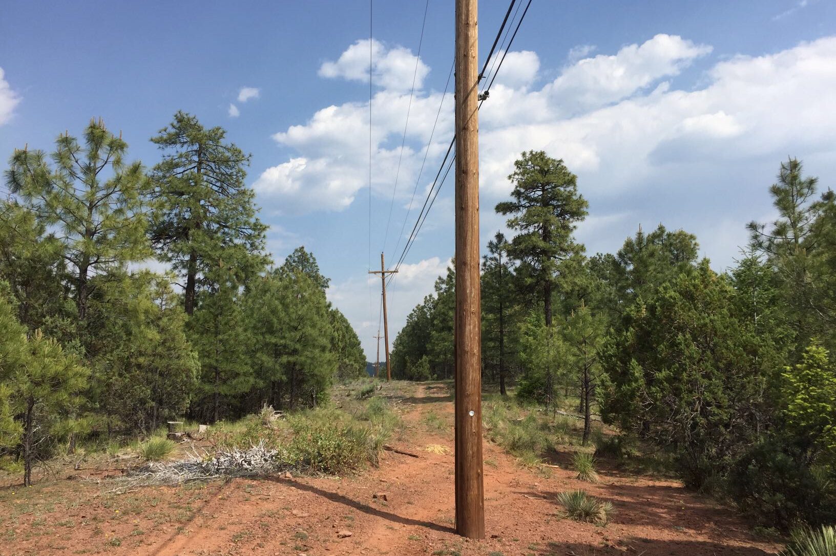
Youngs Canyon to Mormon Lake 69kV Sub-Transmission Line & 12kV Line Environmental Assessment, Coconino National Forest, Arizona
Show More
EnviroSystems was hired as a third-party environmental consultant to prepare an Environmental Assessment and supporting cultural and biological reports for the Coconino National Forest. The Coconino National Forest is proposing to issue a permit that would allow Arizona Public Service Company to construct, operate, and maintain a new 69kV sub-transmission line, substation, and 12kV distribution line on the Flagstaff Ranger District. The proposed 69kV sub-transmission line would extend approximately 17.36 miles and the 12kV extension 4.2 miles.
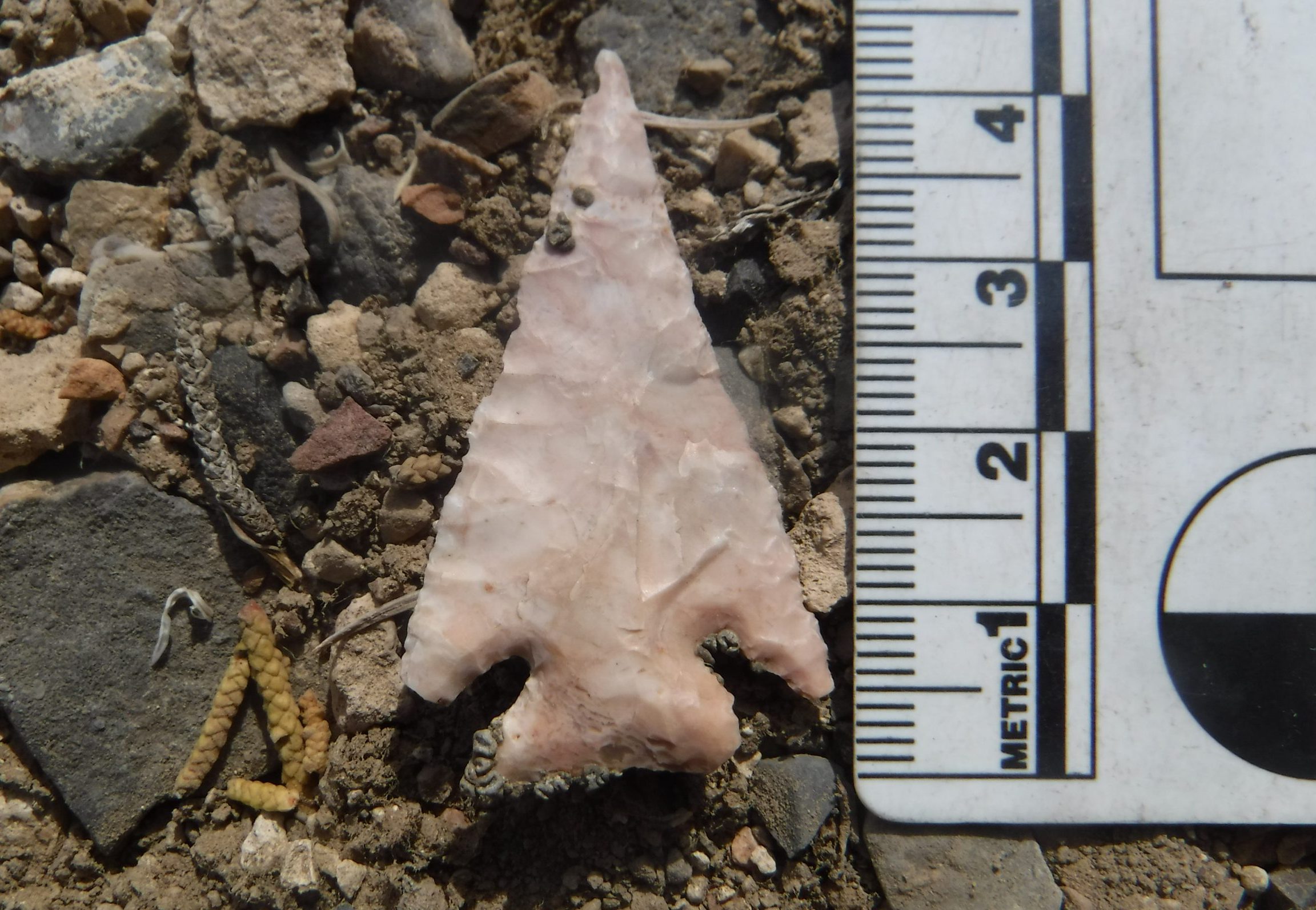
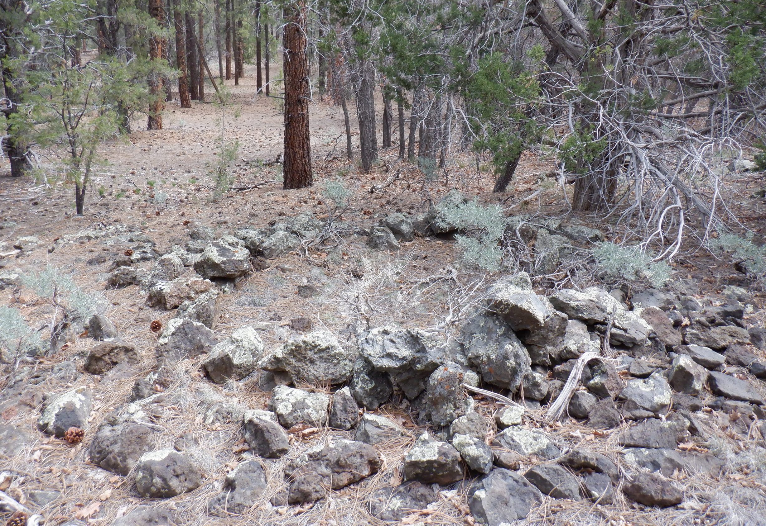
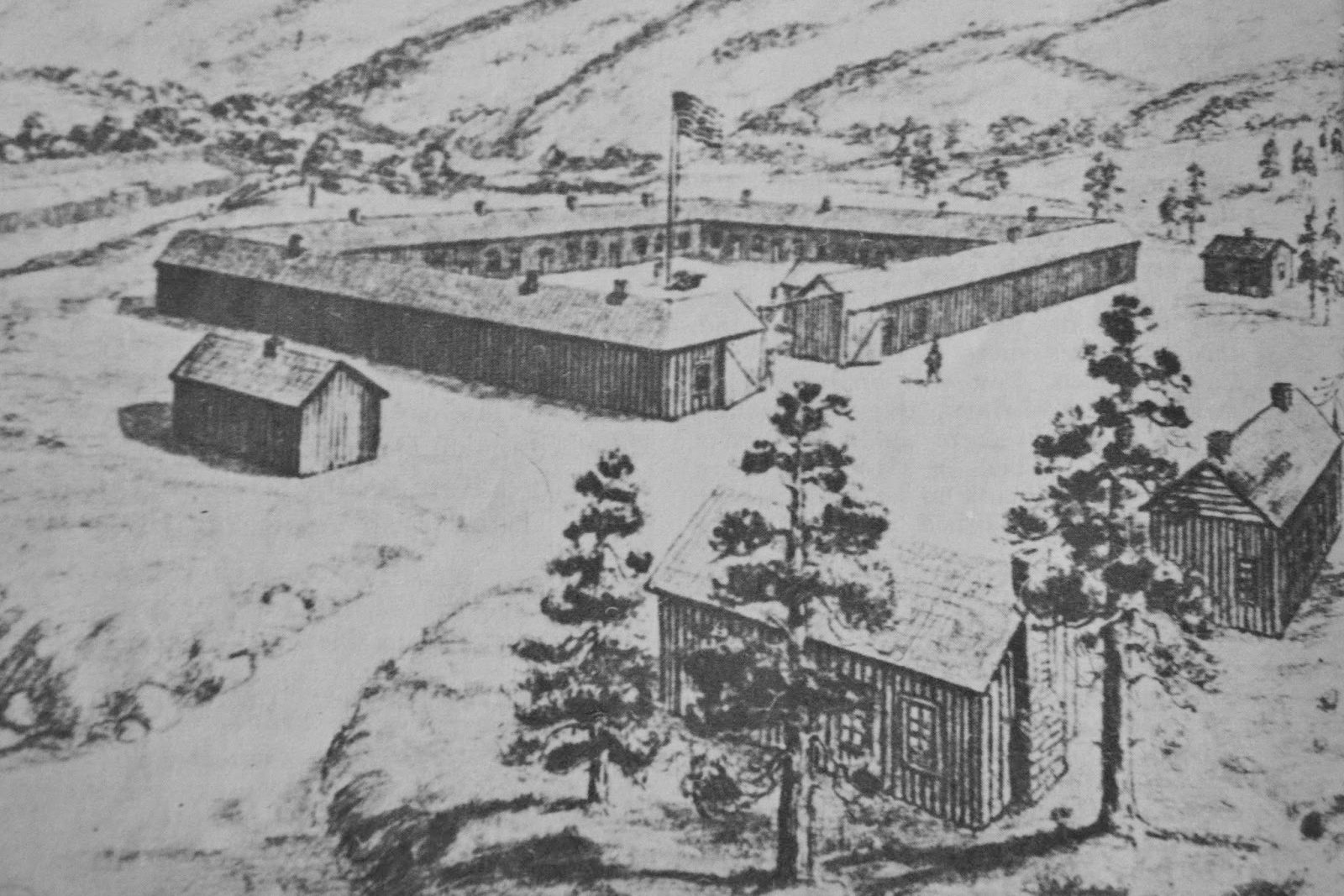
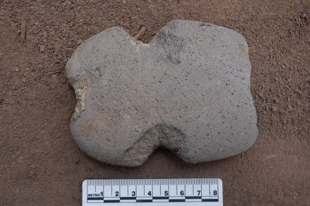
Cultural Resources Projects
Browse examples of recent successfully completed cultural resources projects.

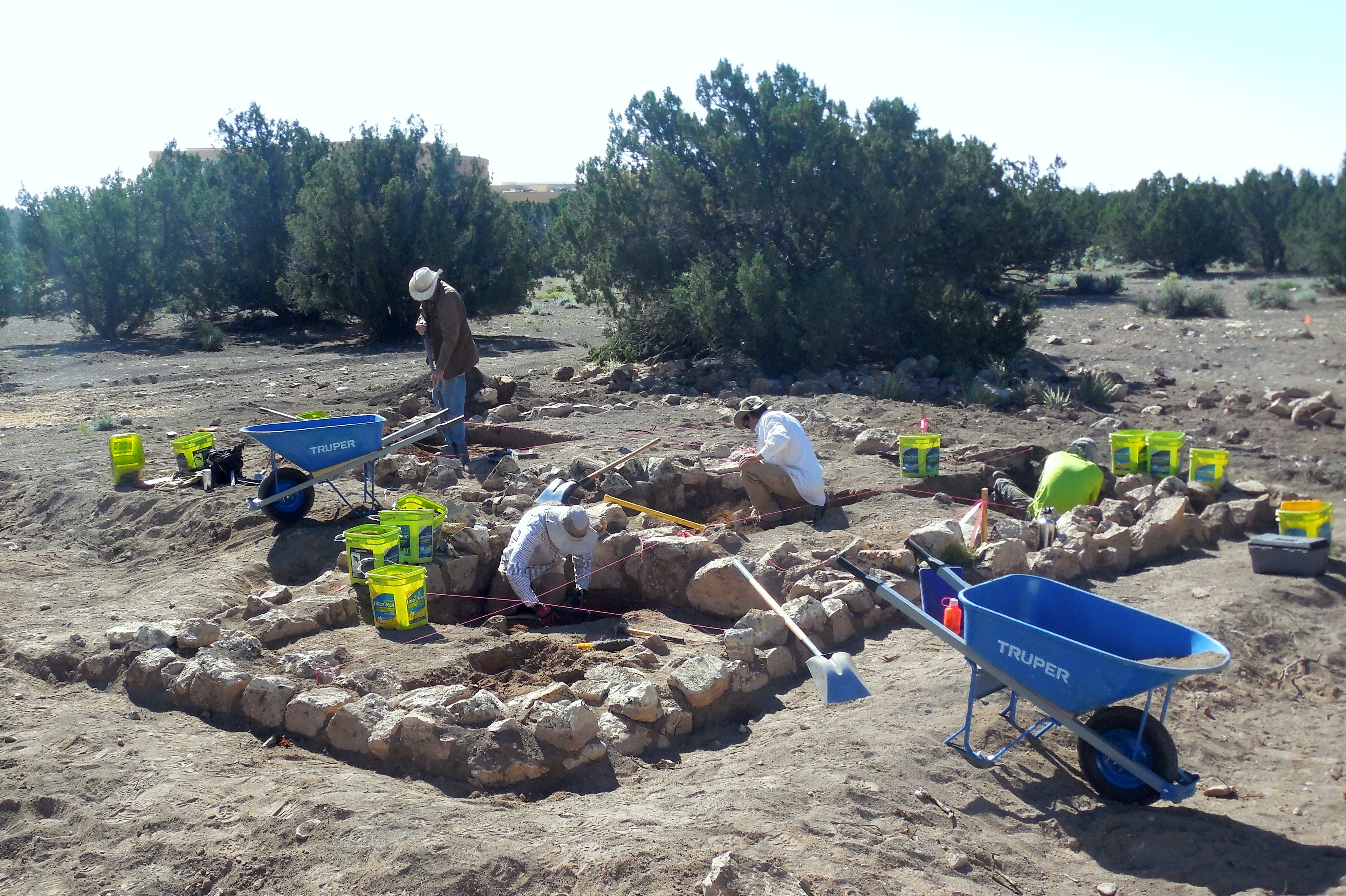
Twin Arrows Navajo Casino Resort Cultural Resources Inventory, Management Planning, Data Recovery Mitigation, and Monitoring
Show More
The Twin Arrows Navajo Casino Resort project represents an undertaking in which EnviroSystems conducted all the various phases of cultural resource management. EnviroSystems conducted a Class III cultural resources inventory of 432.5 acres for development by the Navajo Nation Gaming Enterprise (NNGE) to create the Twin Arrows Navajo Casino Resort. The cultural resources inventory resulted in identification and documentation of 23 archaeological sites. After development and submittal of the cultural resources inventory report, a Cultural Resources Management Plan (CRMP) was created and implemented to guide development.

Ward Mountain Class III Cultural Resources Inventory, BLM, Ely District, White Pine County, Nevada
Show More
In 2020, EnviroSystems conducted a Class III cultural resources inventory for the BLM in White Pine County, Nevada. This particular undertaking is composed of two irregular, but interconnected polygons totaling 7,396 acres. The units are positioned along the west fan of the Egan Range, a north to south trending mountain range south of Ely, Nevada. The BLM proposes to mechanically masticate and chain woody fuels within the project units. Due to the potential impact of fuels treatment related activities, a Class III cultural resources inventory of all 7,396 acres is necessary pursuant to Section 106 of the National Historic Preservation Act, as amended, and constitutes an undertaking that has the potential to affect historic properties, as defined in Federal Regulations 36 CFR 800.16(y). The inventory resulted in the identification and subsequent documentation of 101 new archaeological sites. Associated prehistoric cultural affiliations include the Archaic through Numic periods. Historic sites observed relate mostly to ranching.

Cultural Resource Inventory of the Mt. Trumbull and Wild Cat Units, Grand Canyon-Parashant National Monument, Mojave County, Arizona
Show More
In 2021, EnviroSystems conducted a Class III cultural resources inventory of 4,731 acres. The project area is divided into four units (High Ranger, Section 2, Andrus Rim, and Castle Flat). The High Ranger and Section 2 Units are located near Mt. Trumbull on the Uinkaret Plateau. The Andrus Rim and Castle Flat Units are located near the center of the Grand Canyon-Parashant National Monument (GCPNM) on the Shivwits Plateau. The project area contains vegetation consisting mostly of ponderosa woodland at higher elevations and pinyon-juniper woodland with scrub oak in lower elevations. The Class III inventory will provide baseline data to assist the GCPNM in developing management prescriptions and archaeological site protection strategies. On behalf of the BLM, the work was conducted to provide a 100% cultural resources inventory of the specified project area, collect information on the distribution and character of cultural resources in the area, evaluate eligibility under the National Register of Historic Places, and determine potential effects of vegetation removal on documented archaeological sites. The Mt. Trumbull-Wild Cat Inventory resulted in the relocation and update/redocumentation of 122 previously recorded sites and the identification and documentation of 65 new sites. Associated prehistoric cultural affiliations include the Archaic through Virgin Anasazi periods. Historic sites observed include ranching and logging related locales.

Archaeological Investigations on the Northern Arizona Veterans Affairs Health Care System (NAVAHCS) Prescott Campus
Show More
EnviroSystems has conducted several archaeological investigations on the Northern Arizona Veterans Affairs Health Care System (NAVAHCS) campus in Prescott, AZ under the jurisdiction of the U.S. Department of Veterans Affairs (VA). The campus lies within the boundaries of the Fort Whipple/Department of Veterans Affairs Medical Center Historic District, which is listed on the National Register of Historic Places and is also an archaeological site. For the most complex of the undertakings, EnviroSystems conducted a series of investigations that consisted of an archaeological inventory of the electrical distribution system routes, archaeological monitoring of ground-disturbing activities associated with construction, mitigating a prehistoric burial with two sets of human remains, and mitigating four historic encountered during construction. The total number of archaeological features identified at the site was 92, and 56 point locations representing one or more archaeological artifacts and deposits were also documented. Burial mitigation efforts included consultation, data recovery excavation, analyses, and repatriation. Reports were written for inventory, monitoring, and burial mitigation efforts.

Cultural Resource Inventory of Archuleta Mesa and Stinking Lake in New Mexico and Colorado on Jicarilla Apache Nation and Southern Ute Tribal Lands
Show More
In 2022, EnviroSystems conducted a Class III cultural resources inventory of 14,713 acres for the BIA, Southwest Regional Office on Jicarilla Apache Nation (JAN) and Southern Ute Tribe (SoUte) lands. Known as the Stinking Lake/Archuleta Inventory, the survey area includes roughly 80 amorphous parcels ranging from over 1,000 acres to less than 20 acres in size. Located in Rio Arriba County, New Mexico and Archuleta County, Colorado, the Class III inventory will provide baseline data to assist the BIA, JAN, and SoUte in developing management prescriptions and archaeological site protection strategies. On behalf of the BIA, the work was conducted to provide a 100% cultural resources inventory of the specified project area, collect information on the distribution and character of cultural resources in the area, evaluate eligibility under the National Register of Historic Places, and determine potential effects of vegetation removal on documented archaeological sites. The project resulted in the relocation and update/redocumentation of 41 previously recorded sites and the identification and documentation of 53 new sites . Associated prehistoric cultural affiliations include the Archaic through Gallina periods. Historic sites observed include ranching and railroad related locales.

Cultural Resource Inventory of the Eastern Mount Logan Area, Grand Canyon-Parashant National Monument
Show More
EnviroSystems conducted a cultural resources inventory of two amorphous parcels totaling 3,385 acres. The parcels are located on the eastern periphery of the Mount Logan Wilderness and south of the Mount Trumbull Wilderness in the Uinkaret Mountains, Mojave County, Arizona. The project area contains vegetation consisting mostly of ponderosa woodland at higher elevations and pinyon-juniper woodland with scrub oak in lower elevations. The Class III inventory provided baseline data to assist the Grand Canyon-Parashant National Monument in developing management prescriptions and archaeological site protection strategies. On behalf of the BLM, the work was conducted to provide a 100% cultural resources inventory of the specified project area, to collect information on the distribution and character of cultural resources, to evaluate eligibility under the National Register, and to determine potential effects of prescribed burning on documented archaeological sites. The inventory resulted in the update/redocumentation of 28 previous sites and the identification and documentation of 53 new sites. Most sites are Virgin Anasazi habitations and/or artifact scatters.

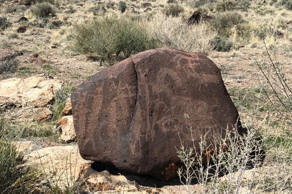
Fillmore Field Office 2016 Respect And Protect Section 110 Rock Art Project: Rock Art Sites Condition Evaluation, Bureau of Land Management, Juab and Millard Counties, Utah
Show More
EnviroSystems conducted condition monitoring at 15 known rock art sites for the Bureau of Land Management (BLM), Fillmore Field Office (FFO). The sites are scattered across west-central Utah from the Deep Creek Mountains at the northwest to Milford at the south. On behalf of the BLM, this monitoring effort is one part of a larger three-part project aimed at fulfilling the FFO’s National Historic Preservation Act (NHPA) Section 110 responsibilities. Project components included (1) a 100% cultural resources inventory of four survey areas to define the character, distribution, and National Register status of previous/new archaeological sites; (2) full redocumentation of the Great Stone Face petroglyphs; and (3) the periodic monitoring of 15 known rock art sites for changes related to visitation/recreational use or natural causes.

Cisco Desert Master Leasing Plan Class III Cultural Resources Inventory, Bureau of Land Management, Moab Field Office, Grand County, Utah
Show More
EnviroSystems conducted a cultural resources inventory of seven linear survey corridors ranging between 8 and 36 miles long and four 40-acre blocks totaling 4,031 acres. The survey areas are within the Cisco Desert MLP, a 321,751-acre area near the Utah-Colorado border. The Cisco Desert MLP was established for resource planning related to oil and gas leasing and development purposes. The Cisco Desert MLP Inventory is a sample survey designed to provide the BLM with information regarding archaeological site density and complexity in the overall Cisco Desert MLP area, to inform on potential adverse impacts of oil and gas development on cultural resources, and to provide information for a predictive model being constructed for the BLM Moab Field Office (MFO). The inventory resulted in the redocumentation or update of 22 previous sites and the identification and documentation of 41 new sites. Sites included historic railroads and prehistoric artifact scatters.

Zion National Park Historic Trail Feature Inventory, Zion National Park, National Park Service
Show More
EnviroSystems inventoried, documented, and evaluated all (n=577) constructed features along seven hiking trails (all National Register of Historic Places eligible). This intensive project involved extensive assessment of historic structures with documentation including intensive mapping, photography, measuring, scaled-drawing, and written descriptions. Fieldwork involved hiking throughout the national park, interfacing with the public, and providing documentation of all historic constructed trail features.
Natural and Biological Resources Projects
Browse examples of recent successfully completed natural resources projects.

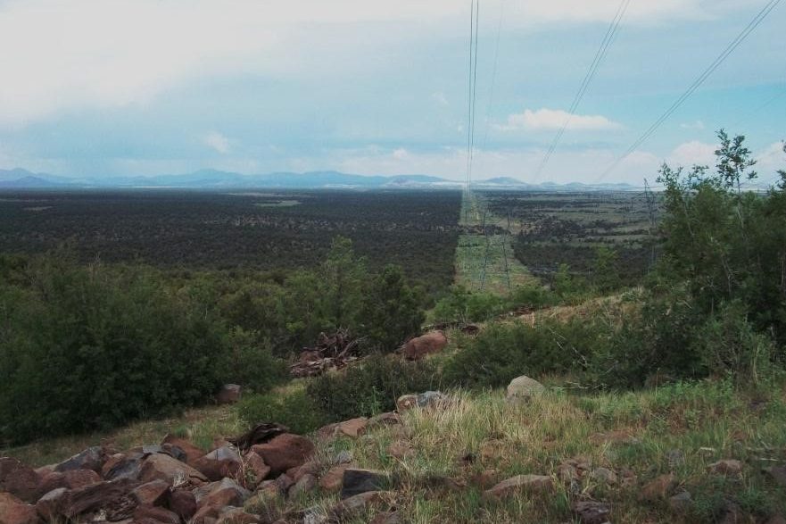
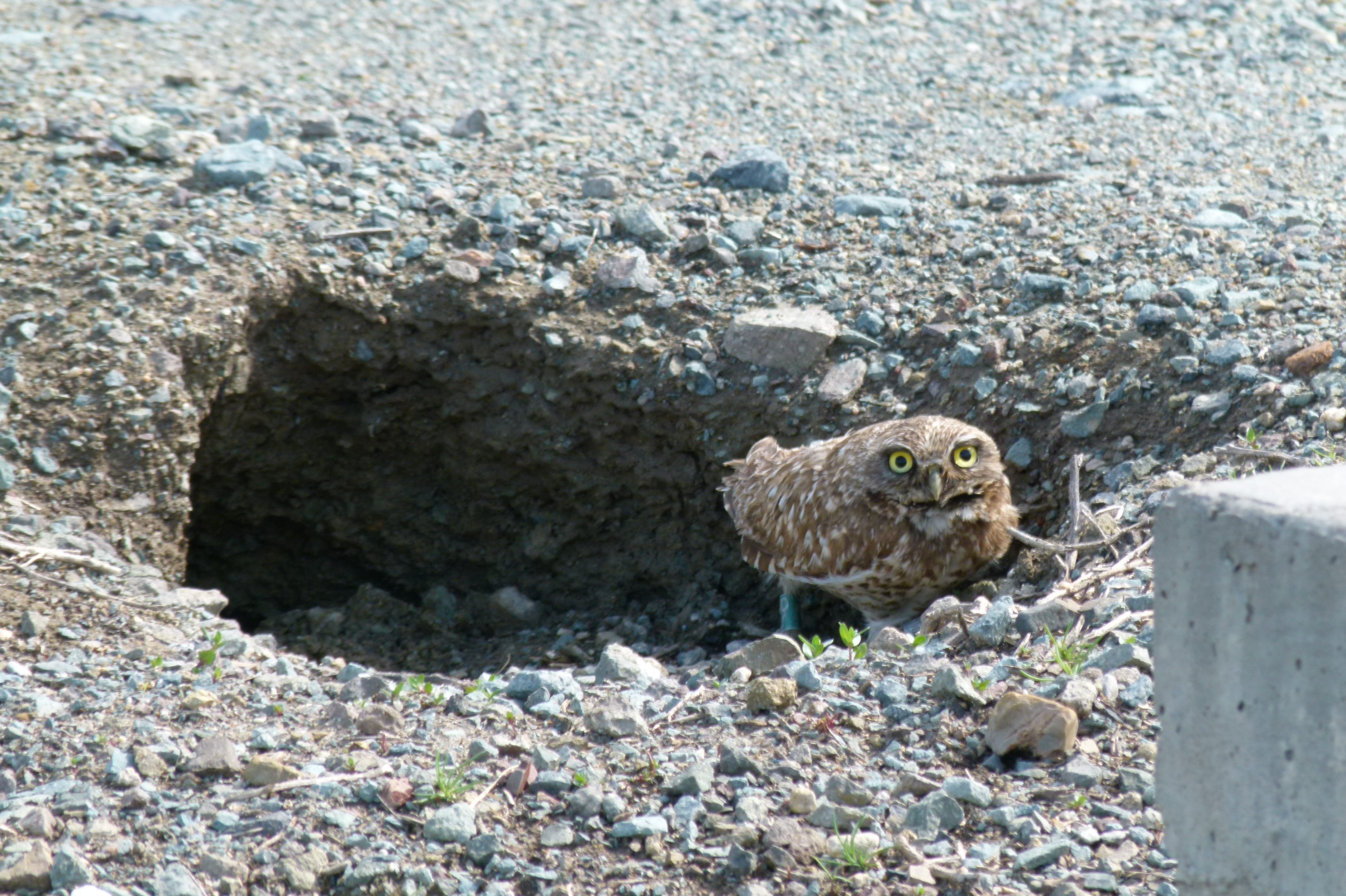
APS Oak Creek Distribution Line Rebuild Environmental Clearance and Biological Monitoring
Show More
EnviroSystems completed environmental clearance surveys in compliance with the Endangered Species Act for a proposed rebuild of the 12-mile SE-14 distribution line running through Oak Creek Canyon on the Coconino National Forest. Protocol and habitat surveys were conducted for Mexican spotted owl (MSO) and narrow-headed gartersnake (NHGS), as well as several special-status plant species. A BA to support consultation with the U.S. Fish and Wildlife Service on effects and mitigation measures was prepared due to the presence of suitable habitat (and critical habitat) for both MSO and NHGS, the timing of the proposed action required special fine-tuning and constant communication between EnviroSystems, the Forest Service, and the U.S. Fish and Wildlife Service to develop suitable solutions for each species. Biological monitoring was conducted for NHGS during construction (six monitors, six days/week, three months).

Brown Field Municipal Airport Wildlife Hazard Assessment, San Diego, California
Show More
EnviroSystems oversaw and participated in monthly point count avian surveys, game camera data collection, and nighttime spotlight biological Wildlife Hazard Assessment surveys for the Brown Field Airport, which is owned the City of San Diego. The goal of the study was to identify all wildlife species that may be of potential strike/damage risk at the airport (including coyote, owls, hawks, doves, jackrabbits, pigeons, and various other species of wildlife). Special attention was given to identify potential impacts to resident federally-listed species protected under the Endangered Species Act and a large population of western burrowing owl that could occur from proposed future developments and changes on the airfield. EnviroSystems performed extensive data analyses to ascertain the overall wildlife hazard condition of the airport and wrote the Wildlife Hazard Assessment and Wildlife Hazard Management Plan, which were both submitted to the FAA for approval.

Minden-Tahoe and Carson City Airports Wildlife Hazard Assessments, Nevada Department of Transportation, Minden and Carson City, Nevada
Show More
EnviroSystems conducted two simultaneous yearlong Wildlife Hazard Assessments at the Minden-Tahoe and Carson City Airports for the Nevada Department of Transportation. Theses airports are full-service general aviation airports located at the foothills of the Sierra Nevada Mountains near Lake Tahoe. The area is recognized as one of the best locations in the world for operating glider aircraft. Through this study, EnviroSystems identified habitats and activities on and near the airport that have the potential to attract hazardous wildlife. EnviroSystems was also contracted to write wrote the subsequent Wildlife Hazard Management Plan in order to provide procedures to relieve or eradicate wildlife hazards to air carrier operations.

Vegetation Inventory Study for Land Management District 5, Units 1, 2, and 3 in Coconino County, Navajo Nation, Arizona
Show More
The Western Navajo Agency, Bureau of Indian Affairs, Branch of Natural Resources has contracted EnviroSystems to monitor established range transects and current utilization. Data will be used to adjust stocking rate for Land Management Grazing District 5, Units 1, 2, and 3 rangeland areas on the Western Navajo Agency in Tolani Lake, Birdsprings, and Leupp Area. EnviroSystems completed a vegetation inventory study on 32 grazing compartments of the Grazing District 5, Units 1, 2, and 3 rangeland areas (excluding the development acres). Approximately 608,968 acres were surveyed through the collection of vegetation data at 690 transects based on soil type and composition.

Red Gap Ranch Pipeline Feasibility Study, City of Flagstaff and Jacobs
Show More
EnviroSystems is participating in a Feasibility Study for a pipeline which is proposed to connect the water supply at City of Flagstaff Red Gap Ranch wellfield to the existing water distribution system. The purpose of the project is to augment the existing demands, accommodate future growth, and diversify Flagstaff’s water supply. The Feasibility Study is designed to develop and evaluate numerous alternatives for environmental issues and potential mitigation requirements in order to determine the most constructible pipeline alignment, as well as identify necessary storage and booster facilities and property ownership along the route. Project elements include a 4,200-acre well-field and 40-mile pipeline to the existing City distribution system.

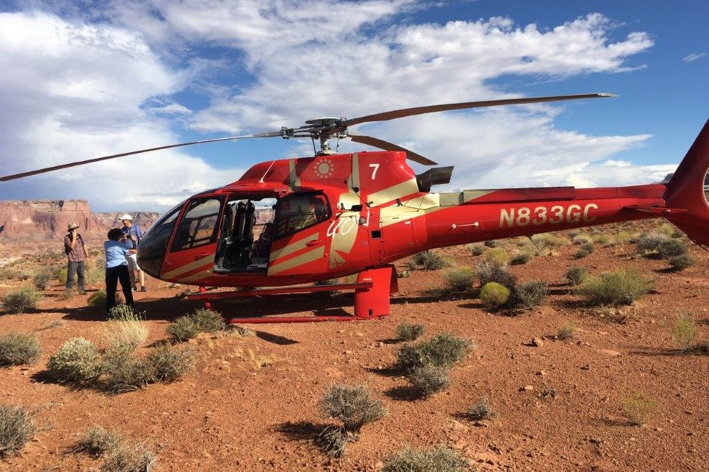
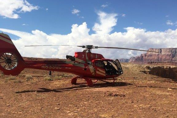
Navajo Nation Parks and Recreation Nine Helicopter Landing Sites, Navajo Nation, Coconino County, Arizona
Show More
The Navajo Parks and Recreation Department (NPRD) is proposing to establish nine helicopter landing sites from near Lee’s Ferry in the southwest along the south shore of Lake Powell to the San Juan arm of the lake northeast of Navajo Mountain. EnviroSystems conducted a biological survey and wrote a biological evaluation to assess habitat and determine the potential effects, if any, that use of the landing sites may have on special-status species listed by the Navajo Nation Department of Fish and Wildlife. EnviroSystems consulted NNDFW’s Wildlife Biologist regarding flight paths and their impacts to migratory bird species and eagles on the Navajo Nation. Given the very real potential for Brady pincushion cactus to occur at one of the landing sites, We conducted a species-specific survey during the flowering season (typically mid-March to mid-April). The survey consisted of 3-meter transects over an approximately 6.65-acre area. Prior to the survey, EnviroSystems’ biologists visited a nearby known population of the species on Bureau of Land Management land to verify that the species was blooming and that it was an appropriate time to survey for the cactus.
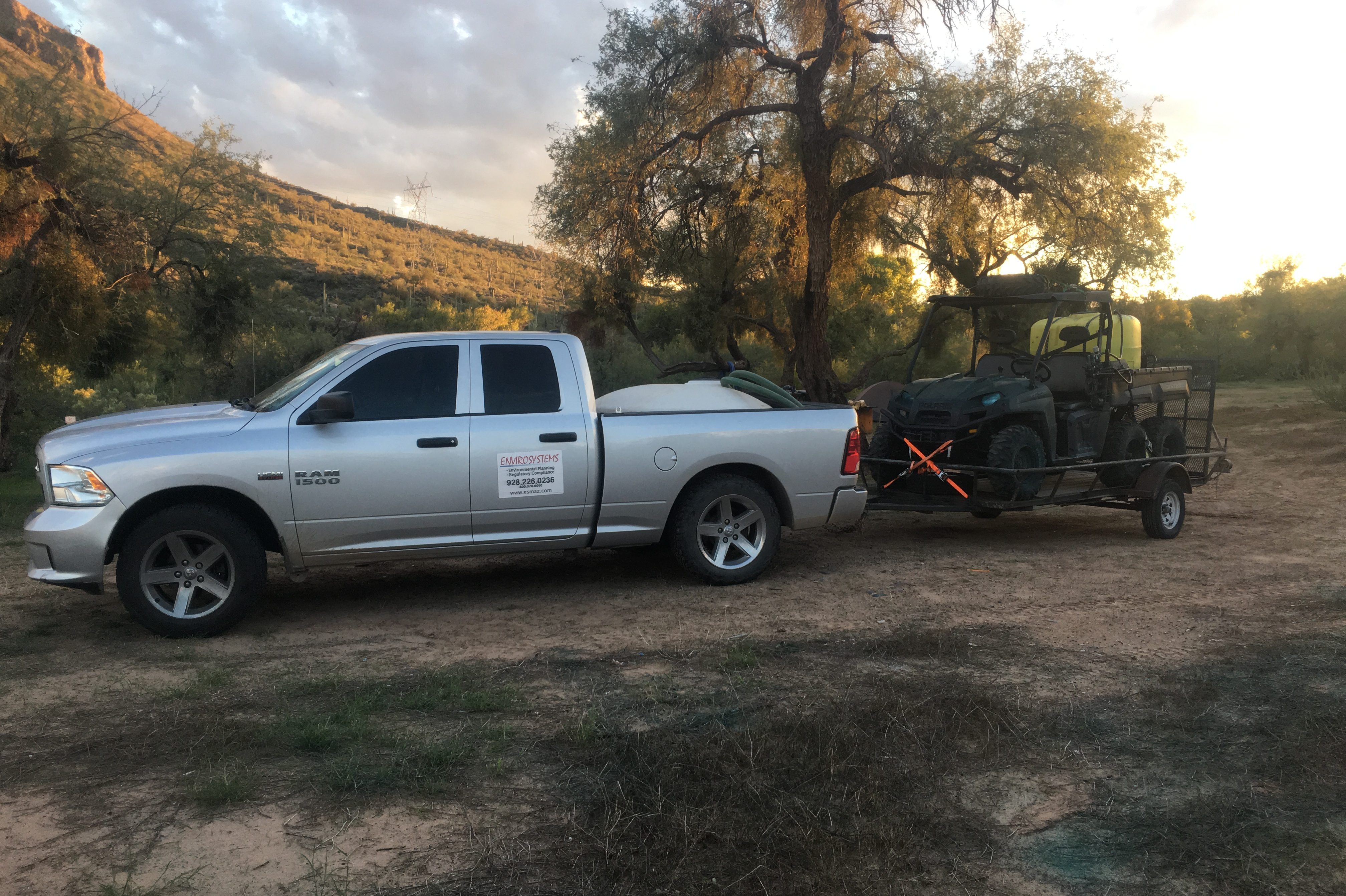
Vegetation Management Projects
Browse examples of recent successfully completed vegetation management projects.

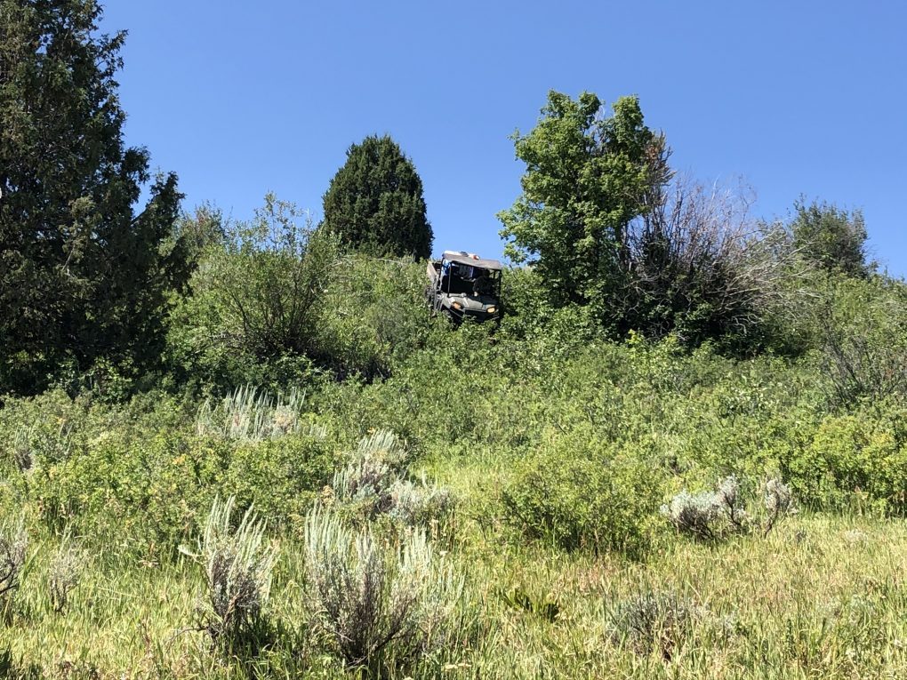
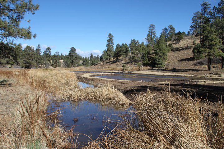
Uintah-Wasatch-Cache National Forest Invasive Species Control
Show More
EnviroSystems was contracted by the Uintah-Wasatch-Cache National Forest (UWC) to perform two seasons of herbicide treatments at six (6) different project locations across the Forest. Project locations included road rights-of-way, trails, parking lots, and undeveloped tracts of land. Prior to commencement of work EnviroSystems reviewed the UWC Invasive Species Environmental Assessment, attended a prework meeting, and developed a work schedule and safety plan. EnviroSystems project manager designed herbicide mixtures that both adhered to the Environmental Assessment and controlled the target species. Methods used for treatments included backpack spraying, UTV spot spraying, and UTV broadcast spraying. In total 1050 acres were treated during the course of the two field season. All work was completed on time and within budget in July 2021. All treatment areas were mapped using a Trimble TDC 100 and Pesticide Application Report Forms were filled out each day documenting environmental conditions, the amount and type of herbicide mixture used, and the locations herbicides were applied. EnviroSystems took care to sign all of the areas prior to any herbicide applications and regularly communicated with the public to inform them of the project.

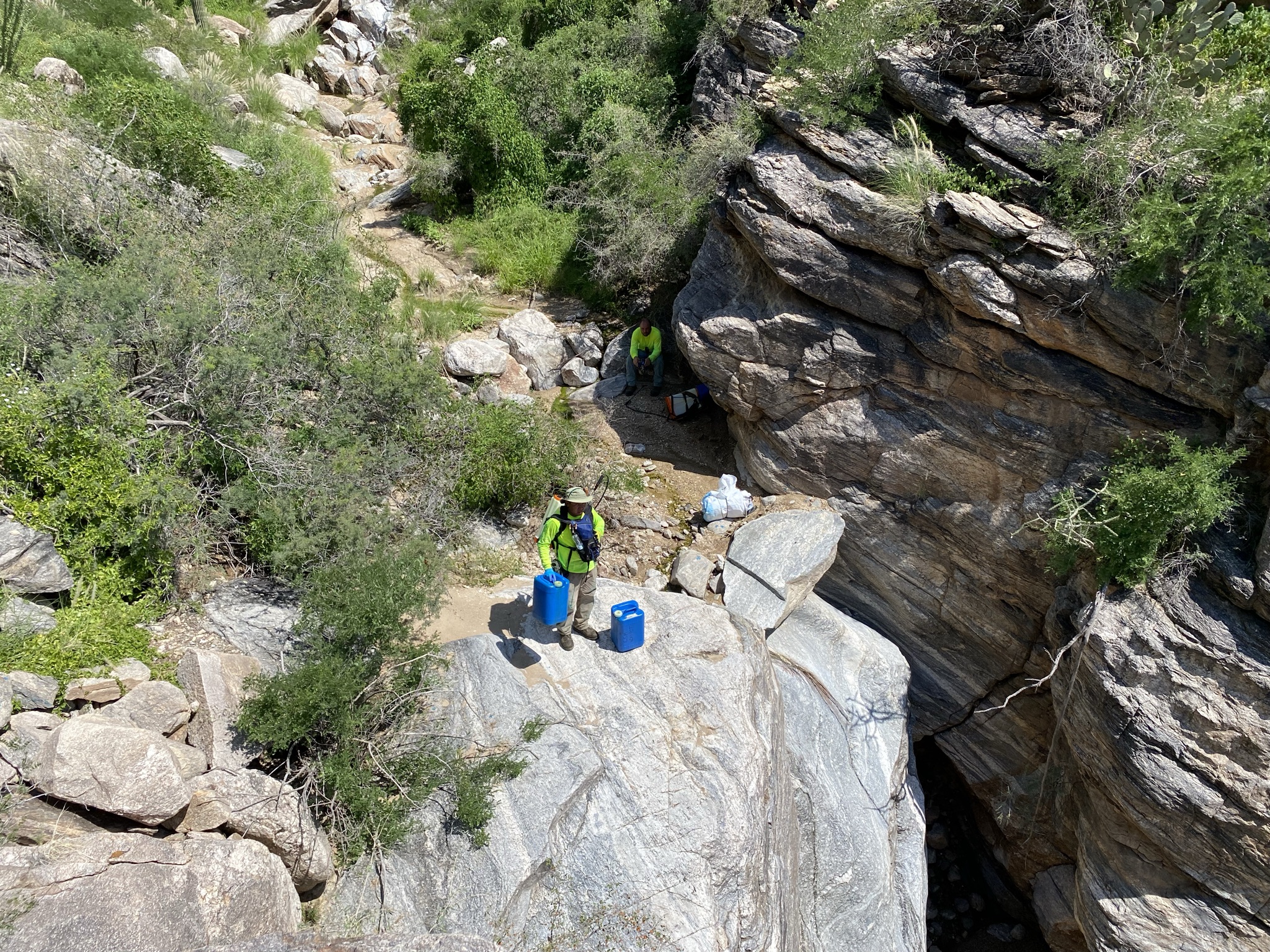
Aravaipa Canyon Non-Native Invasive Plant Inventory (2021)
Show More
EnviroSystems was contracted by the Bureau of Land Management (BLM), Safford Field Office to inventory and map invasive and noxious weed species in the Turkey Creek Area of Critical Environmental Concern (ACEC) and the Aravaipa Canyon Wilderness for a total area of 604 contiguous acres. The survey was performed in a series of two field sessions. Pedestrian surveys were performed utilizing a two-person crew of trained data collectors. Surveyors hiked in and out of the project area each day. Data collection was performed using tablets with Android operating systems provided by the BLM. Tablets were outfitted with the S1 Mobile Mapper application and loaded with the project area and associated data dictionary for data collection.

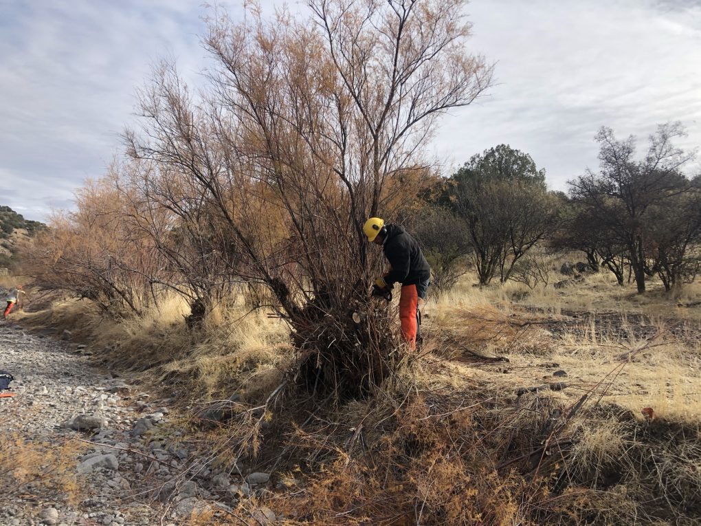
Agua Fria National Monument Tamarisk Cut Stump Projects
Show More
EnviroSystems was contracted by the Bureau of Land Management, Agua Fria National Monument to complete two back country tamarisk removal projects within the Agua Fria and Sycamore Creek riparian corridors. Due to the remote nature of the project areas all equipment necessary to complete the work was packed in by foot. Cutting was carried out using chainsaws, brush saws, and hand tools. All tamarisk stumps were cut as close to the ground as possible and often required clearing of flood debris to access the base of the tree. Cut stumps were immediately treated using an aquatically approved herbicide mix and the cut stems were cut to lengths no greater than four feet. All cutting was completed between December 1, 2020 and March 30, 2021. A follow up visit was performed to treat all regrowth with an aquatically approve foliar herbicide in October 2021.

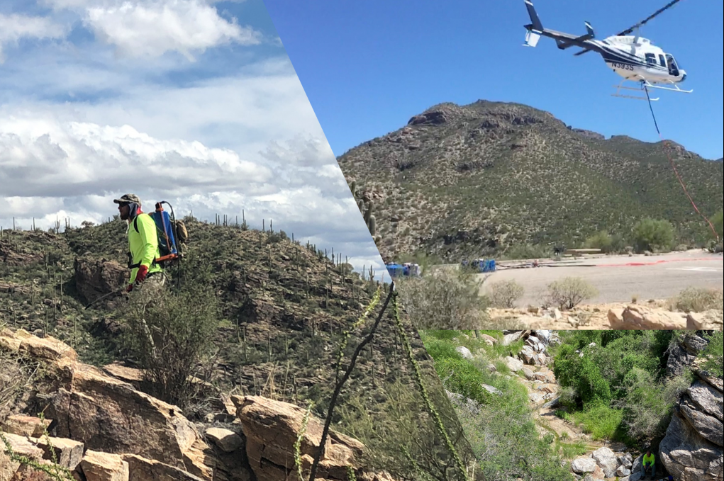
Two Consecutive IDIQ Contracts with Coronado National Forest for Invasive Weed Treatment, Region 3 Forest Service
Show More
EnviroSystems holds the second of two 5-year IDIQ contract with the Coronado National Forest for the identification and treatment of invasive plant species using integrated pest management methods. EnviroSystems has conducted herbicide applications on thousands of acres in canyons on the western slopes of the Santa Catalina Mountains. The primary target species for the Coronado National Forest are buffelgrass, fountain grass, and Johnsongrass. Much of the work is in the Santa Catalina Mountains withing Pusch Ridge Wilderness characterized by steep slopes and deep canyons. Treatment areas are accessible by foot only so EnviroSystems coordinates with a local helicopter service to transport herbicides into the project area to reduce labor necessary for treatments.

Tonto National Forest for Integrated Treatment of Invasive Weeds
Show More
Since 2010, EnviroSystems held multiple contracts with the Tonto National Forest for the identification and treatment of noxious/invasive weeds using integrated pest management methods. Target species include but are not limited to buffelgrass, yellow star thistle, Malta star thistle, Scotch thistle, Canada thistle, diffuse knapweed, sweet resinbush, Dalmatian toadflax, Russian knapweed, spotted knapweed, and giant reed. EnviroSystems furnishes all labor, equipment, supervision, transportation, and supplies, and application is in accordance with all applicable operation plans, chemical labels, and NEPA documents.

IDIQ Contract with Coconino and Kaibab National Forests for Noxious/Invasive Weed Treatments
Show More
EnviroSystems held an IDIQ contract with the Coconino and Kaibab National Forests for the identification and treatment of noxious/invasive weeds using integrated pest management methods. Target species included but were not limited to cheatgrass, yellow star thistle, Scotch thistle, diffuse knapweed, Russian knapweed, Dalmatian toadflax, Malta thistle, bull thistle, whitetop, and leafy spurge. EnviroSystems furnished all labor, equipment, supervision, transportation, and supplies, and application was in accordance with all applicable operation plans, chemical labels, and NEPA documents (e.g. Final EIS for Integrated Treatment of Noxious or Invasive Weeds on the Coconino, Kaibab, and Prescott National Forests).
Geospatial/GIS Projects
Browse examples of recent successfully completed geospatial/GIS projects.

Photogrammetric Mapping at Three Sites in Wupatki National Monument
Show More
EnviroSystems conducted architectural mapping of three sites at Wupatki National Monument, part of Flagstaff Area National Monuments, Coconino County, Arizona. The Monument required scaled planimetric drawings and cross-sections of standing architecture at three sites in the backcountry of the Monument which is also a wilderness study area prohibiting the use of drones for mapping purposes. The standing structures were more than 2-meters-high in some cases generating complications for safe placement of a 3D laser scanner. As an alternative to aerial imagery, laser scanning, and traditional field mapping techniques photogrammetric methods were employed to create a 3D model of the structures at each site. These models were created in AgiSoft PhotoScan Pro and converted into georeferenced orthophotographs. Scaled drawings were completed using ESRI ArcGIS. In addition to plan maps, cross-sections of standing structures were made using digital elevation models derived from the 3D models in ESRI ArcScene. A total of 25 masonry structures consisting of habitation rooms and associated features were mapped at the three sites. The work resulted in a cost-effective alternative to drone mapping and laser scanning for standing architecture.

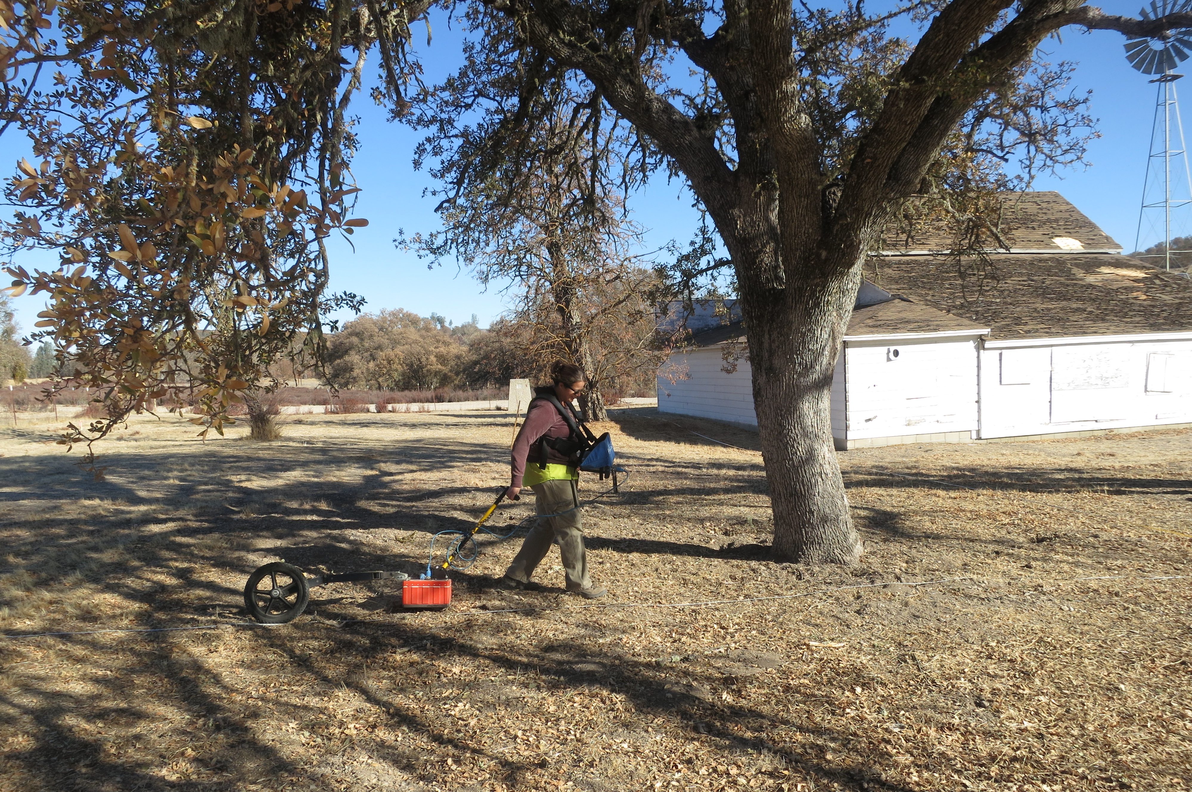
Archaeological Geophysical Survey of the Tidball Property, Fort Hunter Liggett, Jolon, California
Show More
EnviroSystems and Gulf South Research Corporation (GSRC) conducted a geophysical survey of the property surrounding the Tidball Store Site, at Fort Hunter Liggett, California. Although most other structures from the historic town of Jolon have been razed, the Tidball Store is on the National Register of Historic Places (NRHP). The transfer of federal property to municipal ownership and management has the potential to result in an adverse effect under Section 106 of the National Historic Preservation Act (NHPA). Therefore, the U.S. Army Corps of Engineers, Fort Worth District, on behalf of FHL, requested a geophysical survey of the Tidball property in order to identify any significant sub-surface materials or NRHP contributing elements associated with the Tidball Store and the historic town of Jolon. EnviroSystems conducted an investigation used Ground Penetrating Radar (GPR) to cover a total of 0.78 acres at half-meter traverse spacing in an effort to better identify and interpret several anomalies that may represent historic features.

Vegetation Inventory Study for Land Management District 5, Units 1, 2, and 3 in Coconino County, Navajo Nation, Arizona
Show More
The Western Navajo Agency, Bureau of Indian Affairs, Branch of Natural Resources has contracted EnviroSystems to monitor established range transects and current utilization. Data will be used to adjust stocking rate for Land Management Grazing District 5, Units 1, 2, and 3 rangeland areas on the Western Navajo Agency in Tolani Lake, Birdsprings, and Leupp Area. EnviroSystems completed a vegetation inventory study on 32 grazing compartments of the Grazing District 5, (excluding the developed acres). Approximately 608,968 acres were surveyed through the collection of vegetation data at 690 transects based on soil type and composition. The application of geoprocessing techniques was employed to obtain usable acreage for livestock grazing within 1 and 2 miles of reliable water sources. Combining soils types, slopes, and buffer distances within certain grazing compartments determined the appropriate stocking rate and usable potential livestock and wildlife forage in relation to available water in an arid environment.

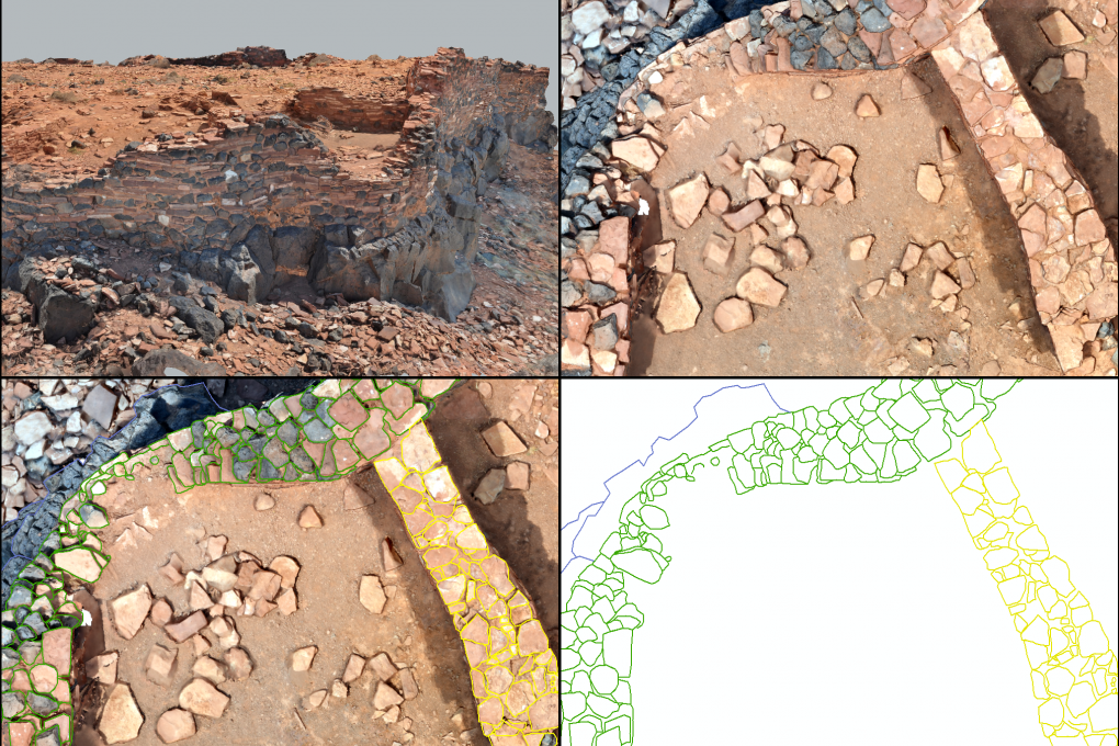
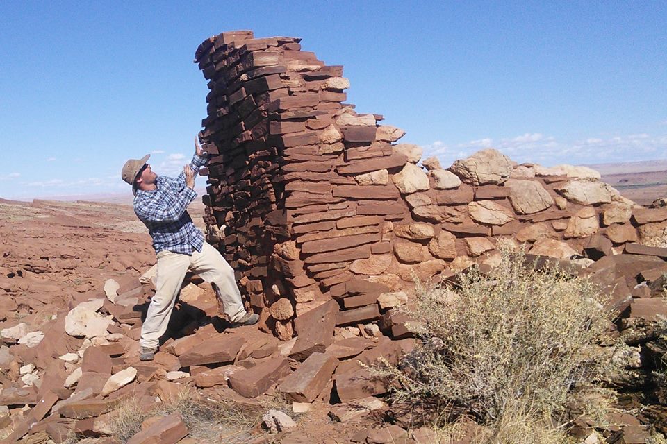
Wupatki Citadel 3-D Modeling Project
Show More
The Citadel 3-D modeling project provided Flagstaff Area National Monuments architectural drawings of the Citadel (NA 355) for future stabilization work at the site. In the Spring of 2021 EnviroSystems used photogrammetry along with site survey and mapping technologies to create a 3D model, a planview map, and architectural cross-sections of the 700 m2, multiroom pueblo. The site is heavily visited by tourists all year round and architectural components are continuously impacted by the visitation. Just under 8,000 images were captured across the site and target locations were recorded using a total station and Trimble Geo 7 GPS unit. The results allow the National Park Service to reference the currently mapped rock walls as natural processes and recreation impact the standing architecture through time.

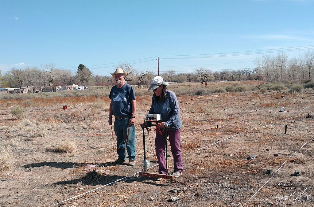
Piedras Marcadas Resistivity 2021
Show More
EnviroSystems personnel have been involve in various geophysical projects since 2006 at the Piedras Marcadas Pueblo in Albuquerque, New Mexico. The latest project involved a supplemental Electrical Resistivity survey at the site. Envirosystems was contracted to collect six 20 x 20 meter grids to finish a long standing project involving geophysical mapping of below surface features and architecture. The clay architecture of the pueblo contrasts significantly with the floodplain sediments along the Rio Grande in the resistivity data. Tiff images of the results and shapefiles of interpretations were submitted to the client.

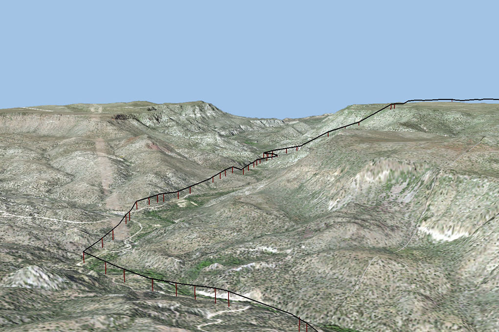
Childs To Strawberry APS Pole Replacement
Show More
In 2021 the Backbone Fire burned 40,855 acres within both the Tonto and Coconino National Forests, damaging existing APS wooden Pole Structures between the Childs Substation and the towns of Pine and Strawberry, Gila and Yavapai Counties. Monsoon thunderstorms caused additional erosion to the powerline and access roads. Emergency repairs included replacement of damaged poles and line, road improvements, and culvert repairs. APS contracted EnviroSystems to monitor ground disturbing activities within or near known cultural resources. The spatial data for this project, collected by various partnering entities using several differing programs and instruments, was managed by EnviroSystems in ArcGIS. The project required constant communications with EnviroSystems, National Forest representatives, APS personnel, and various subcontractors through various mapping applications and hard-copy maps. Storing, analyzing, and sharing the spatial data through ArcGIS was integral to the smooth progression of the project to ensure the timely completion of this important project.
Public Relations and Community Outreach Projects
Browse examples of recent successfully completed public relations projects.

Tri-County Resource Management Plan/EIS Comment Response, Scoping, and Editing, BLM Las Cruces District, New Mexico
Show More
EnviroSystems worked with the Bureau of Land Management, Las Cruces District Office, to provide community engagement and public scoping for the Tri-County Draft Resource Management Plan/Final Environmental Impact Statement (RMP/EIS). The RMP/EIS is required to overcome many hurdles and is a highly controversial project, making the public outreach and community engagement an integral component to the success of the project. EnviroSystems’ GIS analyst also worked extensively with the Bureau of Land Management GIS specialists to conduct a quality control analysis of the data in the Environmental Impact Statement and the changes that were required as a result of modifications to the proposed alternatives.

Public Relations Support and Web Design, Delta Airport Consultants, Prescott Municipal Airport Master Plan Update, City of Prescott, Arizona
Show More
EnviroSystems worked with Delta Airport Consultants to provide public relations support for public meetings, public information handouts and announcements, and web design for the Prescott Municipal Airport Master Plan Update. EnviroSystems provided materials for and helped to facilitate four meetings to present the Master Plan Update to the public as the plan reached 30%, 60%, and 90% designs. We also developed and managed an interactive website for the project that offers a platform for presenting important news, project-related documents, meeting materials, and public comment acceptance.

Special Flight Rule Environmental Impact Statement Public Relations and NEPA Support
Show More
EnviroSystems implemented a public involvement plan (PIP) to gather public comments for the Special Flight Rules Area in the Vicinity of the Grand Canyon Draft EIS. To give the public and stakeholders an opportunity to review the Draft EIS documents in person and provide input, we assisted the National Park Service in hosting three open house meetings in Phoenix and Flagstaff, Arizona and Henderson, Nevada. We coordinated the logistics for all three meetings, provided hosting services, and developed and distributed a news release announcing the dates, times, and location of each open house. EnviroSystems provided information to the public in the form of a project PowerPoint presentation, Google Earth overview, slideshow, effective commenting display, instructional handout for the National Park Service website to access project and comment information, and a stenographer for those who were not comfortable with or unable to provide written comments. We gathered all public comments, coded them for analysis using a coding system that categorized comments by project topics, and entered them into the Planning, Environment, and Public Comment database system as part of the public review of the Draft EIS for the Special Flight Rules Area.